Monday, April 14, 2014

Northburn Station 50k Mountain Race

Weeks have passed since my first ever ultra marathon - a 50k mountain race held at Northburn Station in Cromwell.  To sum things up: I came. I ran. I took 10 hours to reach the finish line. Wooo!


During the pre-race meeting we were warned about spaniard, an angry cow, and hypothermia/hyperthermia/hyponatremia/hypotension.  We were also given instructions for what to do when an urge to use the bathroom strikes - find a large rock to duck behind.  Yeah... No facilities for 30 miles.  That was going to be interesting.

We started running the first loop around the vineyard in the dark. I did a fair job of not tripping and I climbed the first of five or so locked gates pretty well.


It took four hours of walking/running to get to the top of the big climb.  At points, it was so steep that people used the fence to brace themselves!


Some people thought I was nuts for thinking 50k in the mountains sounded like fun.  I treated it like a day of fast tramping - I took in the sights and had lots of snack breaks. :)  The views up there were great!


I didn't expect the temps to reach 80 degrees... running 30 miles with no tree cover was quite challenging.  I stayed hydrated with water, Powerade and my secret weapon - Coca Cola.  I kept the food side of things simple - muesli bars, pretzels and my other secret weapon - crystalized ginger.


There was come pretty strange landscape that felt like running on mounds of desiccated moss. The rest of the route undulated.... just when you thought you weren't going to run uphill again, you were running uphill again.


This woman, in the pic below, and I played leapfrog for 49 kilometers.  She blazed past me in the last kilometer!


I was feeling really good when I hit the marathon mark (26 miles/42 k), but then the wheels started falling off a little.


I was having trouble spotting markers on the course (I can't see red on brown/green very well - thank you colorblindness genes) and I couldn't fix the hot spots on the bottoms of my feet (I lost one half of my favorite pair of socks to run in and did not discover this fact until the day before the race).  A really friendly spectator walked with me for the last kilometer. When she suggested I run the last few hundred yards to the finish line, I just looked at her pathetically and said I couldn't be bothered.  Ha!

I vowed to never do another race like this again, since I didn't balance thesis, job, and training very well (binge training by doing four hour runs on the weekends isn't ideal!).  But... now I'm thinking the Dunedin marathon (in September) would be a nice tune up race for some more ultras next year. We'll just have to wait and see!

Sunday, April 13, 2014

Partying in the Backcountry

Tramping! Pictures! Fiordland!

A few weeks ago, I co-lead a trip to McKellar Hut, on the Greenstone Track for the Otago University Tramping Club.  My co-leader was FABULOUS and we had a great time.

So lush!

We started on the Routeburn track for a wee bit - wooooh! When I'm on this track I feel like I'm home. I love it sooo much!

Good weather! Unusual for Fiordland

We didn't hustle to get to the hut - instead, we had mandatory group photos on our snack breaks.

Punter sandwich: co-leaders on the end and punters (newbies) in the middle

The walk to McKellar Hut takes just a couple hours, so we extended the trip to include a hike up to McKellar Saddle.

Boardwalk leading to the track up to the saddle

Most hikers/trampers will tell that it's super important to pack light. But, our hike was pretty puny and so we loaded up with food for two breakfasts, two lunches and a dinner for 10 trampers: three loaves of bread, two packets of crackers, 1 kg of cheese, an oversized container of hummus, canned tomatoes, canned beans, fresh veggies (broccoli, onion, carrot, corn), beer, a few packets of TimTams, oats, dried fruit, nuts, Milo, tea...oh and chocolate. Lots and lots of chocolate.

Lunch on the saddle

After lunch we just roamed about for a bit and then made tracks down to the valley.  We wanted to get to the hut and ditch our packs to lighten our load and explore the area a bit more.

Lake McKellar and McKellar Hut in this direction

Once at the hut, I found a spot in the river to chill my beer.  I filled a pot with water, put the bottles in, and placed a few rocks on top of the lid so it wouldn't wash away.  Ella and I took our group to the lake while I waited for my beer to reach a drinkable temperature.  We spent ages trying to figure out how to spell "YONZO" (You're Only in New Zealand Once) with our bodies.

Y.O.N.Z.O.

By the way, my Tuatara A.P.A. (Aotearoa Pale Ale) tasted AMAZING!  I didn't bring any to share, so I drank it sneakily.

Photo credit: Ella Borrie

That night, Ella and I taught our punters how to perform a proper TimTam slam (because it would be unacceptable for an exchange student to go home without this know-how).  Another OUTC group was staying in the hut and their trip leader hiked in with a CARROT CAKE in her pack.  OMG! YUM!  Before we indulged, we took turns sharing our worst birthday (mine was lame in comparison to the other stories; I shared my experience of walking around Arlington Cemetery with the Girl Scout troop for my 10th birthday).  Ella had the bright idea of taking it one step further... all of a sudden we were nominating the top worst birthdays to be voted on as New Zealand's Shittiest Birthday.  Ella was the game show host and had the audience vote for the worst birthday.  The other trip leader lit some candles on the cake, as we all sang happy birthday, and revealed the winner of NZSB by handing the cake to them to blow out the candles. Weird, but fun times.

On Sunday, we took a detour to Key Summit.  The views were great!


Actually, it was a quite nice place to rest. :)

Photo credit: Sarah Baker

No current plans for tramping as my thesis has taken over my life.  Hoping to be back out in the hills soon, though!

Saturday, March 08, 2014

Routeburn: Emily Pass

Two years ago, I was part of a small group of students from the Otago University Tramping Club that made its way to Mt. Xenicus as part of the annual trip to Paradise, New Zealand.  I was challenged beyond my expectations and as a result I became determined to more challenging tramping trips.  

So, when it was time to plan day walks as part of this year's Paradise trip, I raised my hand to lead a difficult one... Maybe, just maybe, there would be other new trampers out there who could make it through a 12+ hour day of walking if I promised lots of encouragement and really awesome views.

I chose to lead a trip to Emily Pass.  The plan was to walk two hours to the Emily Creek Bridge, leave the track to follow the creek up to the basin, go over the pass and down to Mackenzie Hut within five hours, and then hop back on the Routeburn track to follow it for six hours to read the carpark at the Routeburn Shelter.

Oh, how naive I was to think it would be that simple!

We woke up in the dark to choke down breakfast and catch a van ride to the start of the track.  It was a slow going tramp to the basin (note for next year: less bush bashing and more time in the stream bed). 

Routeburn Flats

Once in the basin, I could make out the depressions to the right of Emily Peak.  Unfortunately, I misinterpreted Moir's Guide North when it said something about the extreme true left. 

Look how far we'd come!

I went too extreme and lead the group up to something that did not turn out to be Emily Pass. We backtracked and made our way to the correct pass (just a few struggles with the "uncomfortably steep" section that the guide warns about). 

There are three trampers in this photo :)

Chocolate makes everything better

Feeling victorious

From the pass, Mackenzie Lake looked close-ish.  It wasn't. It took a total of 13 hours for my group to get from the car park to the hut... it was supposed to take that much time to do the whole walk!


I made the decision that our group would stay in the hut for the night (Great Walk huts cost $54/night, so it was a costly decision to make for six people).  It was better than dealing with the alpine environment in the dark (we had six to nine hours of walking to go, according to the warden).  The hut warden was AMAZING and radioed someone who went to the campsite to let the club President know my group was safe. 

The next morning we got up in the dark and high-tailed it for five and a half hours to the car park.  Thankfully, there was a van waiting (with a driver!) to take us back to Dunedin. (The rest of the club was to walk to Lake Sylvan, pack up, and head back to Dunedin... I was supposed to drive a van back to Dunedin.)

There were a lot of lessons learned on this trip: food, water, and clothes to stay warm and dry are KEY, club trips aren't the best time to try out a hard route, communication prevents Search and Rescue from being contacted, and a positive attitude keeps the whole group from turning into mental milkshakes.  I've made LOTS of notes about this trip and I hope to lead it next year.

Next weekend is another club trip and I'm leading a group again (with a co-leader!).  This next one will be all on track and we've already planned on staying in a hut.  I'm really looking forward to it!


New Zealand Tour Guide: Part V (Queenstown)

The final destination on our south island tour was Queenstown.  I love this little spot on the water, below the mountains.  Interestingly, it was Jo and Mary's least favorite place!  Queenstown is more crowded than the other towns we visited and so it took a bit to adjust after a week of being on quieter tracks and trails.

Now, I talked and talked to Jo and Mary about a hike up the Ben Lomond track, but when push came to shove we went for the gentler walk up Queenstown Hill (which still requires medium to high fitness).  At the summit, I encouraged Jo and Mary to do fun poses to mimic the ones that I see exchange students in all the time (you know, the kind where the whole group of friends has jumped and the photo is a snap shot of everyone mid-air).  Well, these kind of photos are best left to the under 25 crowd because us older folks just look downright special when we're on top of a hill hopping around.

Here is the least cringe worthy jump shot (seriously):


And, here's where I'm looking a little more foolish:


To preserve my friendship with Jo and Mary I'll refrain from posting their photos!

We decided a cruise on Doubtful Sound would be a great rest day activity (we had done some serious walking everyday for a week by this point).  The weather was typical for Fiordland: rainy.  But, we still had a lovely time puttering around on the water (twice, in each direction).

First boat ride across Manapouri:


At least the rain fed lots and lots of waterfalls!


I hoped to see dolphins on the cruise, but they were hiding. Hmph

Our last big adventure was a loop track with a view of Lake Rere and the surrounding Greenstone track.  


It was a shame we didn't get to spend more time in Fiordland, but I think Jo and Mary got a good taste of New Zealand's changing landscapes.  My next American visitor arrives next month and I'll take this opportunity to see what else New Zealand has on offer: river rafting, luge rides, flying foxes, etc. (I deliberately left out skydiving and bungy jumping!).

Wednesday, March 05, 2014

New Zealand Tour Guide: Part IV (Tekapo and Mt. Cook)

We left Christchurch to drive to Queenstown.  On the way, we stopped to admire Lake Tekapo and walk around Mt. Cook National Park.  The water and mountains in both places were glorious.


This stone church overlooks Lake Tekapo and is quite popular in tourist-y calendars...


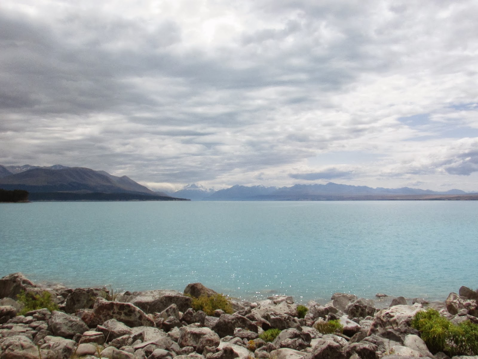
Typically, I've stopped at a lookout on the left side of Lake Pukaki to take photos of Mt. Cook, but we found a nice spot from the Kettlehole track to be shutterbugs instead.


I lead Jo and her Aunt Mary down the Hooker Valley.  The valley is seriously amaaaazing (I'd love to see it in winter sometime!).  The walk is easy enough for visitors with a little fitness and determination. You can't see the peak of Mt Cook in this picture.  Aoraki is the Maori name for the mountain and the "cloud piercer" was hiding under clouds until we started heading back to the car.


 I had hiked along the Tasman valley before, but this was my first time walking around the "Blue Lakes".  It was nice to get away from the small crowd that gathered at the nearby lookout to view the Tasman Glacier.

Definitely a quiet picnic spot that I'd recommend.


What's a trip to Mt. Cook village without a little elevation gain?  We walked the Red Tarn track for a new perspective of the area.


I scrambled a little higher above the red tarns... what a view!


Our adventures didn't stop here. No, sir.  Up next: Queenstown...

Thursday, February 27, 2014

New Zealand Tour Guide: Part III (Akaroa and Christchurch)

Jo, Mary and I headed north to tour the south island. Akaroa was our first stop.  Holyfreakamoly - that place was AMAZING!  Just. so. pretty.

We drove along the scenic route and it was quite the drive! The switchbacks kept my passengers on the edge of their seats - they're not used to such narrow roads and driving on the "wrong" side of the road. The battery on my camera was dead, so I don't have pictures of the route (which follows the edge of a crater).  Unfortunately, by the time we got to our accommodation (a Top 10 Holiday Park) the clouds had settled in, so we couldn't see the pretty blue water.  BUT, the sun coming through the clouds looked really neat!


We strolled around town to find something to eat and search the town for French influences.  There was a little walk along the water and it brought us to this lighthouse:


Now, there is a highly recommended 2- or 4-day walk on the Banks Peninsula track (4 days starts at $230), but we opted to choose our own adventure.  (It would be really awesome if I could find someone to go back and do the track with me!) 

Our first walk was down Pigeon Bay.  This was a 5 hour walk in great weather.  We crossed mostly agriculture land and so the track wasn't too challenging.


We tried doing an hour of the Skyline Circuit that evening, but the weather blew clouds in (again). 


After our time was up in Akaroa, we moved on to Christchurch for a night at the Chester Street Backpackers.  It was really important to me that I share this part of New Zealand with my friends, so that they could see a city that they were helping rebound from the earthquakes by being there and spending money in town.  During the day we walked around the city (the container mall in particular) and checked out the cardboard cathedral.  


After our brief stay in The Garden City, we headed west to Mt. Cook National Park - my visitors' favorite place out of all the places we visited!  I'll post those pictures soon. :)

Wednesday, February 26, 2014

New Zealand Tour Guide: Part II (Dunedin)

Right here in Dunedin there is lots to do.  Jo and her aunt did the Cadbury Tour ($16), a trip on the Taieri Gorge Railway (trips start at $50), a walk up Signal Hill (free), a stroll to see the glow worms in Nicols Creek (free), meandered on St. Clair beach (free), and trekked to Tunnel Beach (free).  They stayed at the Arden Street House which is in a nice spot because it's a very short walk to New World (a grocery store) and the Botanic Garden (there's a free timed 5k park run through the gardens on Saturdays!) .  Unfortunately, there wasn't enough time to check out Baldwin Street (the world's steepest street) or the St. Clair hot salt water pool. 

On Waitangi Day we drove to Moeraki to see the boulders.  We stopped at Katiki Point on the Moeraki Peninsula first.  I HIGHLY recommend this spot to folks who want to see wildlife.  We saw heaps of seals and two penguins. (Seriously make this place a must-do! We saw so many seals here that when we boated past a seal colony on the Doubtful Sound cruise we didn't get upset by the mad rush of other passengers to see them - our views were way better here!)  Unfortunately, we didn't stop at Fleur's Place for lunch or dinner due to the 20% holiday service charge. (*sad face*)  This restaurant is supposedly fantastic for seafood.

Penguin!

View from Katiki Point Reserve

Fur seals having a yarn

Moeraki Lighthouse


Moeraki Boulders

We walked from the carpark at one end of the beach to the boulders and back.  I can't recall how long it took us, but we had no problem with the distance (probably because we picnicked before walking out to the boulders).

Jo and Mary were super keen to see lots of New Zealand and do lots of walking, so we drove up to Banks Peninsula to start our tour of the south island.  I did most of the driving, but Mary had a few goes at driving on the left side.  I think it was quite the experience for her!  More details (and pictures!) to come.

Tuesday, February 25, 2014

New Zealand Tour Guide: Part One

Today, I went for a spectacular run along Swampy Ridge.  I started from home, headed up the Pineapple Track, turned towards the Swampy Summit track and then followed signs into the Silverpeaks.  This is the same route that I ran a few weeks ago when the weather was horrible.  I didn't go down Swampy Ridge because the fog was so thick, but today's view was amazing!

Pacific Ocean (center), Otago Peninsula (top right), Swampy Ridge track (foreground)

I was aiming for a 5-hour run as part of my Northburn 50k training. I finished it in 4 hours 20 minutes and felt great at the end. Not too shabby.

So, what did I think about out there all by myself?  Well, I reflected a lot on how my PhD is coming along (I've been here for two years and have one more to go!) and I thought a lot about how fun it was to have my friend Jo and her Aunt Mary in New Zealand. I loved playing Tour Guide for the two of them!  I hope to get pictures up from their visit soon because I'm leading a tramping trip this weekend and I'll want to post photos of that, too.

Before I do that, here's a quick, rough intro to their trip:

Days 1 & 2: Fly from New York to Dunedin, New Zealand
Days 3 - 7: Dunedin
Days 7 - 9: Akaroa (Banks Peninsula)
Days 9 - 10: Christchurch
Days 10 - 13: Mt. Cook
Days 13 - 15: Queenstown
Days 15 - 18: Dunedin

This trip was heavily centered around walking/hiking and I think we saw some really great places/scenery.  We spent 1-5 hours at a go on our walks (some days we had more than one long walk).  Some walks were flat and some were steep hikes with steps.  I would recommend this sort of itinerary for others who want to see a lot of New Zealand's south island on foot, but with some minor tweaks.  I'd cut a day off of Mt. Cook or Queenstown to go to Te Anau.  Fiordland is beautiful and I'm sad that Jo and Mary saw it mostly from the bus as we made our way to Doubtful Sound.

So that's the teaser for the next lot of blog entries. YAY!